
Public Domain Map Tools
By @RobLabs
State Pages Redesign
Jun 27, 2024
The State Pages for NPS.gov have been upgraded to use MapLibre and the latest NPMap architecture from the Web Maps team at NPS.gov.
You can visit each of the 56 state & territory pages by adding your state’s abbreviation (in lower case) in the link to NPS.gov:
NPS.gov/<state-abbreviation>
For example, see the State Page for Alaska, or Massachusetts or Wyoming for your self by using these tiny URLs from NPS.gov.
See NPS-State-Pages.mov to view in another tab, or to download.
Geospatial PDFs
Apr 11, 2023
Mobile device users for iOS & Android can make use of geospatial PDFs to view maps offline.
How it Works
When the protocol is https://, and the link is opened on a mobile device, it will open in the web browser. When you change the protocol to avenzamaps:// and Avenza Maps is already installed, then the link will open in Avenza. It will be downloaded, then processed for use as an offline map with GPS location.
Some NPS Park Units instruct customers to use “Avenza Maps”, search where units instruct customers to use Avenza at NPS.gov.
Rocky Mountain Fire Management Example
- Open RoMo geospatial PDF in Browser
- https://github.com/roblabs/maps-for-non-profits/releases/download/NPS/Rocky.Mountain.National.Park.Fire.Mangement.pdf
- Original asset from NPGallery.NPS.gov
- Or, Open RoMo geospatial PDF in Avenza Maps. Click on this link after you have Avenza Maps installed:
📲 🗺️ avenzamaps://server/Rocky.Mountain.National.Park.Fire.Mangement.pdf
Joshua Tree Example
- Open JoTr geospatial PDF in Browser
- https://github.com/roblabs/maps-for-non-profits/releases/download/NPS/Joshua.Tree.pdf
- Original asset from NPGallery.NPS.gov
- Or, Open JoTr geospatial PDF in Avenza Maps. Click on this link after you have Avenza Maps installed:
📲 🗺️ avenzamaps://server/Joshua.Tree.pdf
Install Avenza Maps for iOS or Android
Please see https://support.avenzamaps.com/hc/en-us/articles/5051433392020-Importing-maps-from-custom-locations for technical support.
- 📱
- Install from Apple App Store.
- 🤖
- Install from Google Play.
Weather from National Weather Service
Jan 23, 2023
🌡️ ☁️ ☀️ 🌦️ Weather.gov APIs for alerts & weather
Weather.gov has public facing weather data for both the public and developers. For example, at Cabrillo National Monument you can see the current weather, alerts and a forecast:
A customer can use the map at forecast.weather.gov to adjust their location, and save a bookmark for future reference.
Weather.gov also has programmable API, where a location is passed to /points and the response a GeoJSON. Also note, if you pass too many digits of precision, the /points response will round it down to four significant figures, or an approximate precision of about 10 meters.
Since the response is GeoJSON, it can be opened the Park Tiles version of GeoJSON.io
Within the GeoJSON data response from /points, there is a property called forecast:
MapLibre Plugins
Jan 9, 2023
MapLibre Plugins of interest to public domain maps.
Dec 12, 2022
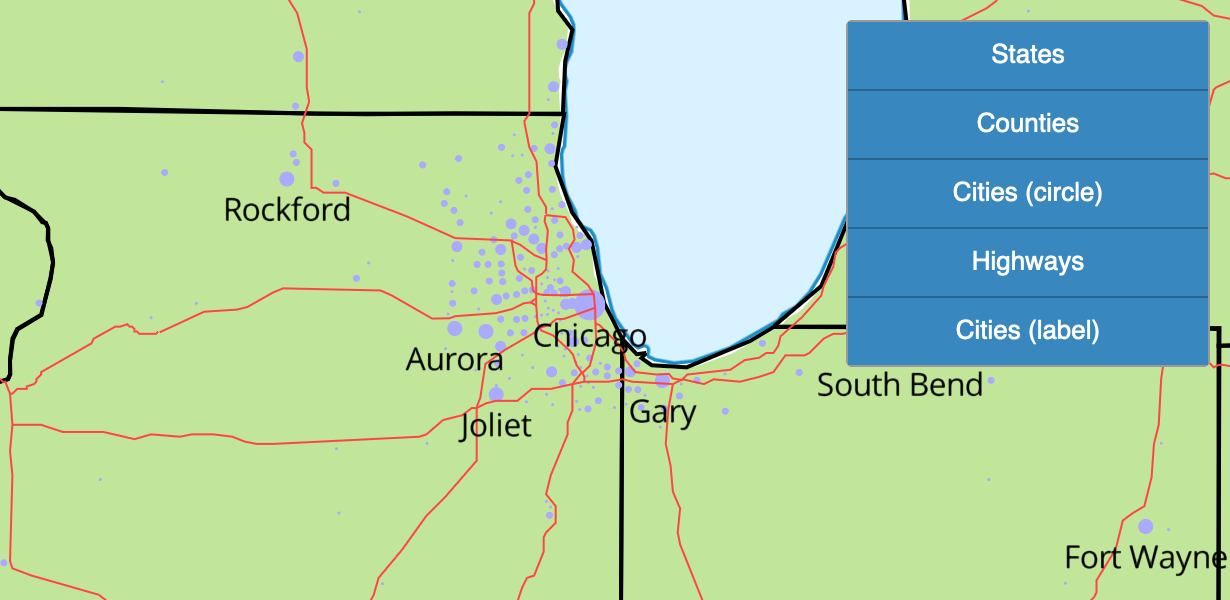
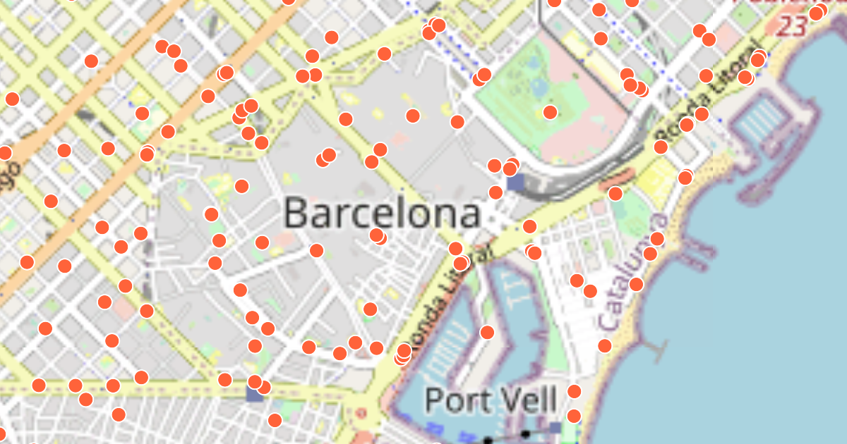
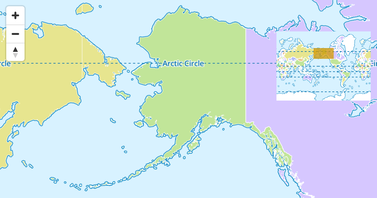
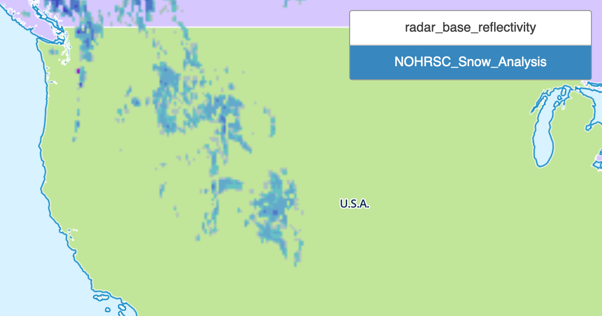
MapLibre Plugins for ArcGIS layers, Carto layers, Interactivity, Overview map and WMS layers. See NPMap5 Plugins for live demos.
🗺️ 🔌 🧭 📍 Examples of the NPMap5 Plugins: Interactivity, Overview, Layers (ArcGIS, Carto, WMS)
 ArcGIS layer
 Carto layer
 Interactivity
 Overview map
 WMS layer
Updates to GeoJSON.io for Public Domain Maps
Nov 18, 2022
We have made updates to GeoJSON.io by adding a button to easily add GeoJSON data from a URL onto a custom styled map. See the custom styled map at RobLabs.com/geojson, and use the notes below to visualize your own GeoJSON data via URL.
🗺️ 📍 Visualize GeoJSON in Joshua Tree National Park
GeoJSON.io was developed by Mapbox and is “a quick, simple tool for creating, viewing, and sharing spatial data”. It is a perfect way to visualize, test or learn how GeoJSON data is created, formatted, styled or inspected.
Open GeoJSON at RobLabs.com/geojson
- Say you want to visualize this GeoJSON from Joshua Tree:
- You can open a version of GeoJSON.io with Public Domain Styles
- RobLabs.com/geojson
- Since we are using a style served by Mapbox protocols, then we can make use of the latest Mapbox projections & rendering SDK.
- Check out the help section for details on how to import data into this tool. The help section is the in the upper right corner of the web page.
- Once have opened the app, then paste your GeoJSON URL into the menu item Meta, New Window.
- Sub-windows > Meta > 🪟 New Window with GeoJSON URL, then paste your GeoJSON
- Or, Click on this link, which encodes the GeoJSON URL
🗺️ 📍 Visualize GeoJSON from Natural Earth Data
Open GeoJSON at GeoJSON.io
Natural Earth Data can be loaded a GeoJSON URL. The encoded URL for the Tiny Countries GeoJSON data from Natural Earth is
Video 🎥 🔈: GeoJSON.io with Public Domain Maps
Park Tiles Style Offramps
Oct 3, 2022
If you have an Atlas style, This Observable notebook demonstrates how to use Atlas styles in other rendering tools such as QGIS, ArcGIS Online, MapLibre or GeoJSON.io. See the JavaScript Notebook at https://observablehq.com/@roblabs/park-tiles-style-offramps.