Cleveland National Forest
By @RobLabs
The southern-most National Forest in California
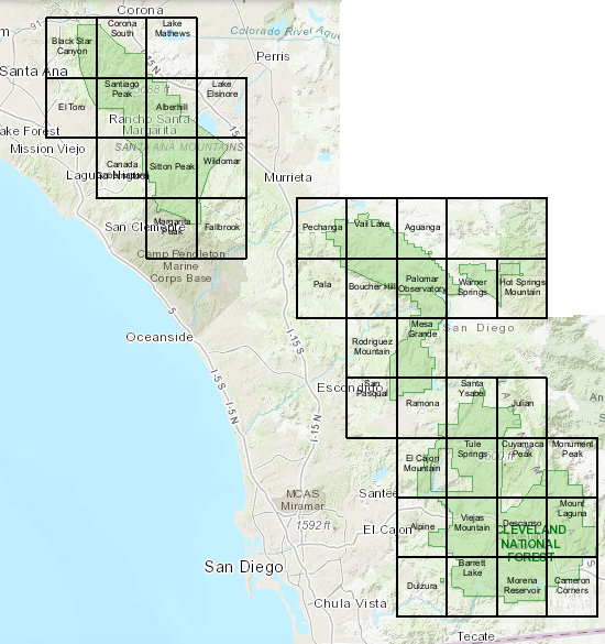
The Cleveland National Forest has three Ranger Districts. Click on the links below to see a full size map of each.
Each Ranger District map is made of several 7.5 minute Forest Service Topo maps. These maps are stitched together and compressed to fit efficiently into a mobile phone and web pages. See RobLabs.com/mobile1st for the full presentation on how we use Forest Service and USGS data in our maps.
- Trabuco Ranger District - Spans these 7.5 minute quadrangles from the Forest Service
- Black Star Canyon, Corona South, Lake Mathews, El Toro, Santiago Peak, Aberhill, Lake Elsinore, Cañada Gobernadora, Sitton Peak, Wildomar, Margarita Peak, Fallbrook
- Palomar Ranger District - Spans these 7.5 minute quadrangles from the Forest Service
- Pechanga, Vail Lake, Aguanga, Pala, Boucher Hill, Palomar Observatory, Warner Springs, Hot Springs Mountain, Rodriguez Mountain, Mesa Grande, San Pasqual, Ramona, Santa Ysabel, Julian, El Cajon Mountain, Tule Springs, Cuyamaca Peak
- Descanso Ranger District - Spans these 7.5 minute quadrangles from the Forest Service
- El Cajon Mountain, Tule Springs, Cuyamaca Peak, Monument Peak, Alpine, Viejas Mountain, Descanso, Mount Laguna, Dulzura, Barrett Lake, Morena Reservoir, Cameron Corners

